
|
Autriche 1918 – 1945 |
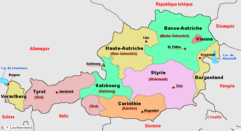
Autriche au sein de l’Europe, subdivision administrative
|
Burgenland : Burgenland |
|
Kärnten : Carinthie |
|
Niederösterreich : Basse-Autriche |
|
Oberosterreich : Haute-Autriche |
|
Salzburg : Salzbourg |
|
Steiermark : Styrie |
|
Tirol : Tyrol |
|
Vorarlberg : Vorarlberg |
|
Wien : Vienne |
Wien, capitale – subdivision administrative
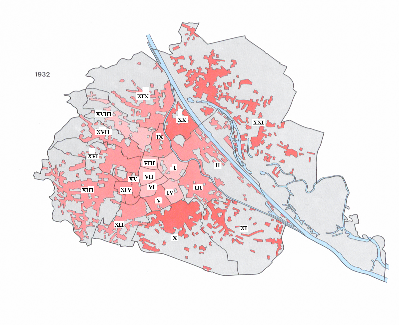
Wien – arrondissements au moment des élections de conseils municipaux d’avril 1932
1. Innere Stadt
2. Leopoldstadt
3. Landstraße
4. Wieden
5. Margareten
6. Mariahilf
7. Neubau
8. Josefstadt
9. Alsergrund
10. Favoriten
11. Simmering
12. Meidling
13. Hietzing
14. Rudolfsheimn
15. Fünfhaus
16. Ottakring
17. Hernals
18. Währing
19. Döbling
20. Brigittenau
21. Floridsdorf
Modifications de frontières ultérieures :
– 14 décembre 1932, entre le 13 et le 16 arrondissement
– 17 octobre 1935, entre le 16 et le 17 arrondissement
– Lorsque la "Grande Vienne" a été créée après l’annexion de l’Autriche à l’Allemagne en 1938, les districts 23 à 26 ont été formés à partir de 97 communes de Basse-Autriche; la nouvelle division administrative a été fixée le 15 octobre 1938.